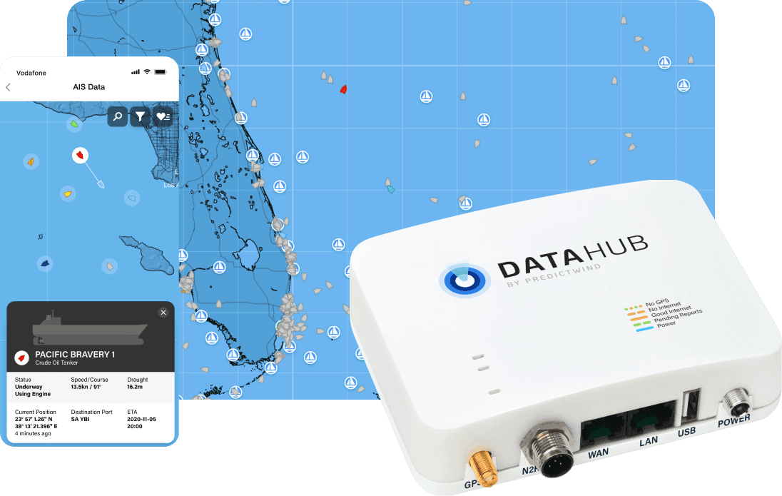

AIS Offshore
In a world-first, download vessel positions within a 300 Nm radius via a satellite connection.

Search
Search via vessel name or MMSI number.

Favorites
Add friends or vessels of interest to your Favourites list.

Real time Satellite
View any vessel anywhere in the world with Satellite AIS.

Real time terrestrial
View land based AIS position feeds.

Vessel Type
Each boat identified from over 30 vessel types.

Filter
Control what type of vessels you see on the map.

Vessel Status
View speed, direction, draught, destination and ETA.
oha.heading

The world’s best AIS Data
We source this AIS data through our partner KPLER; the world leader in satellite AIS vessel position data. Many sailors are familiar with the App Marine Traffic. This is the exact same data source that PredictWind receives.
Now you can literally see any vessel in the world transmitting their position via VHF on the AIS system. View highly congested commercial traffic routes, fishing fleets or simply find your friend's boat that is transmitting its position via AIS.

Share AIS Data
Be a part of improving the quality and safety of AIS data worldwide. In addition to highly accurate GPS tracking and communications tools, the DataHub® transforms your boat into a terrestrial AIS reciever station.